Discover the scenic routes and attractions dotted along this 10km nature trail in the southwest of Singapore!
Conceptualized in 2002 by Urban Redevelopment Authority (URA), the Southern Ridges trail was officially opened in 2004 at a cost of S$25.5 million.
The 10km long trail takes one from Kent Ridge Park to Harbourfront via a series of parks, bridges and walkway. With scenic views and award-winning attractions, the Southern Ridges is undoubtedly one of the most popular nature trail in Singapore
Jump to:
Southern Ridges Route A & B
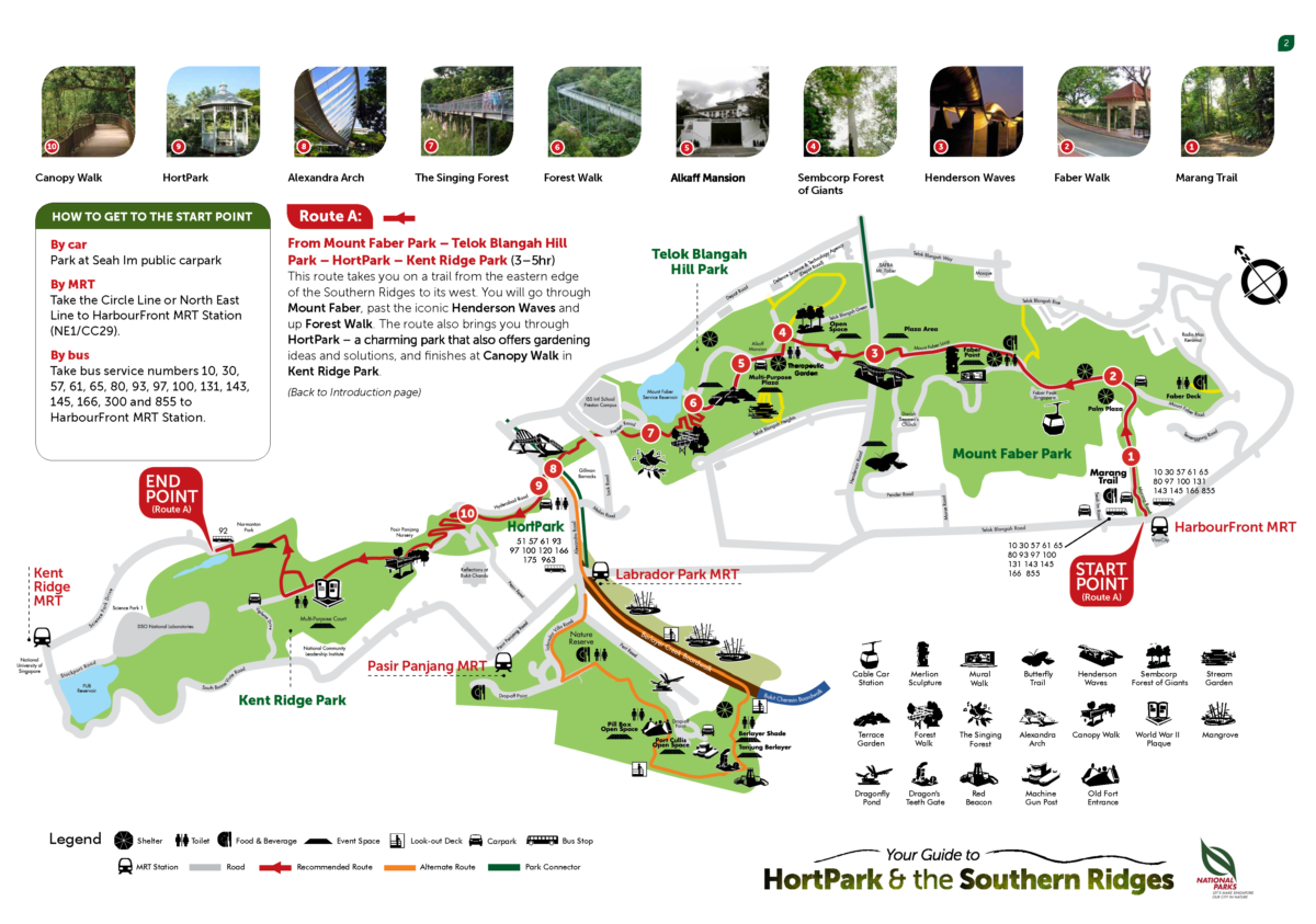
There are two recommended routes to hike the Southern Ridges trail.
Route A (Popular):
Route A is a more complete trail that covers the entire Southern Ridges from Mount Faber to Kent Ridge Park, making it the preferred trail among hikers. The entire trail stretches 10km and takes approximately 3 to 5 hours to complete.
Checkpoints:
- Harbourfront MRT Station (Exit D)
- Mount Faber Park
- Telok Blangah Hill Park
- HortPark
- Kent Ridge Park
- Pasir Panjang MRT Station or Kent Ridge MRT Station
Route B (Recommended):
Route B largely follow the first half of the Southern Ridges trail. After crossing the Alexendra Arch, Route B diverts away from HortPark and takes the coastal trail along Labrador Nature Reserve. The more varied attractions at Labrador Nature Reserve make route B the recommended trail for those who are looking for nature, sea, and history.
Checkpoints:
- Harbourfront MRT Station (Exit D)
- Mount Faber Park
- Telok Blangah Hill Park
- Labrador Nature Reserve
- Labrador Park MRT
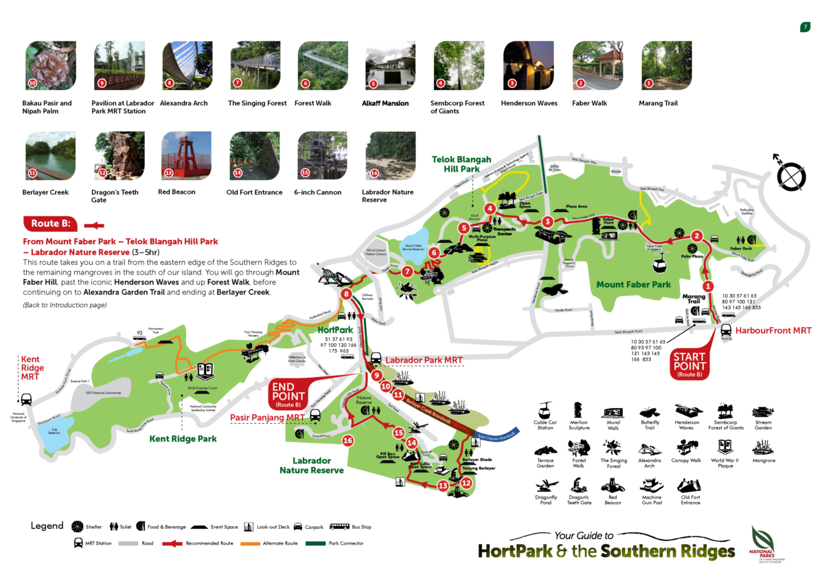
Below are a list of attractions along the Southern Ridges trail.
Mount Faber Park
Mount Faber park is easily accessible via the Marang Trail which starts at Marang Road. Marang Road is located right beside Harbourfront MRT Exit D.
Faber Peak
Mount Faber Park is home to Faber Peak where the Mount Faber Cable Car Station is located. Mount Faber Station is the starting point for the Mount Faber Line and links up to Sentosa island via the Harbourfront Station and Sentosa Station. Dining outlets can be found at Faber Peak.
Faber Point
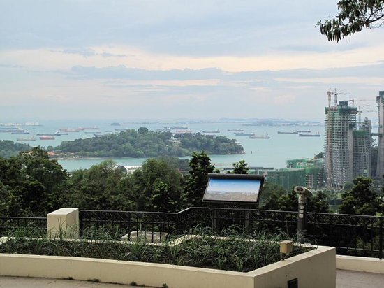
At the top of Mount Faber Park is Faber Point, Singapore second highest hill. At 106m tall, Faber point offers a bird’s eye view of the Singapore’s southern coast. Also located at the hill top is a 3-metre Merlion statue, one of seven official Merlion sculptures authorised by the Singapore Tourism Board.
Henderson Waves
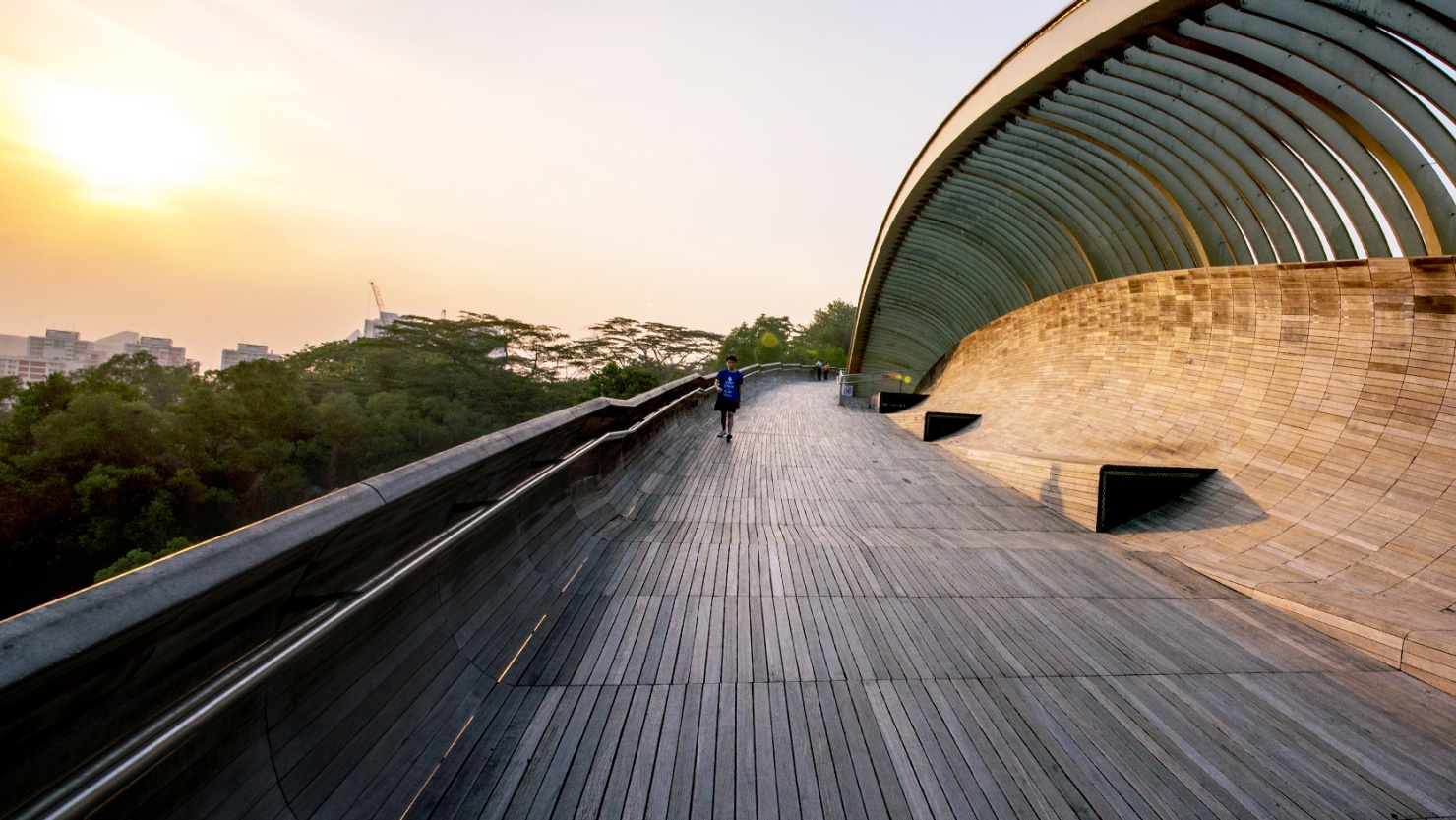
Linking Mount Faber Park and Telok Blangah Hill Park is the award-winning Henderson Waves.
At 274 metres long and 36 metres above ground, the Henderson Waves is the tallest and second longest pedestrian bridge in Singapore; the DNA-liked Helix Bridge at Marina Bay takes the acclaimed title of the longest pedestrian bridge in Singapore with a length of 280 metres.
With its undulating curved ribs made up of dense Balau wood, the wave-like structure of Henderson Waveshas become a go-to-spot when one visits the Southern Ridges.
Telok Blangah Hill Park
Once a place of gathering for trading communities, the 34-hectre Telok Blangah Hill Park has evolved to become one of the largest park along the Southern Ridges.
Terrace Garden
Located at the hilltop of the park is the Terrace Garden, a series of semi-circular terraces that offers a panoramic view of Singapore. The scenic landscape of the garden have also made it a popular spot for wedding photos.
Sembcorp Forest of Giants
Over 600 giant trees — some reaching over 80 metres tall at maturity — make up the Sembcorp Forest of Giants at Telok Blangah Hill Park. The arboretum consist of over 55 species and are sponsored by Sembcorp Industries as part of its efforts enhance biodiversity in urban areas. Most of the trees are still at its infancy and will take approximately 50 years to mature and reach its full height.
Alkaff Mansion
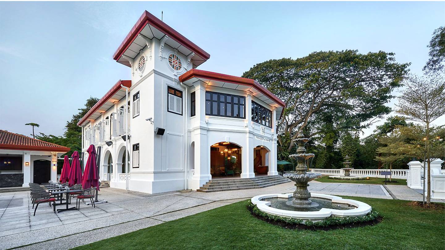
The Alkaff Mansion is a colonial bungalow built by the prominent Alkaff family in 1918. Once a gathering place for notable members of the society, the place was sold off after the end of World War II. It later became the headquarters of the World Buddhist Society before being acquired by the government in 1984. Today, the mansion is a multi-lifestyle dining destination with various restaurants including UNA, Txa, and Wildseed Cafe.
Forest Walk
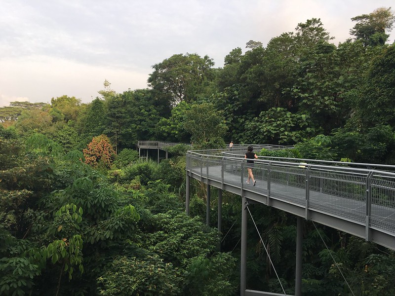
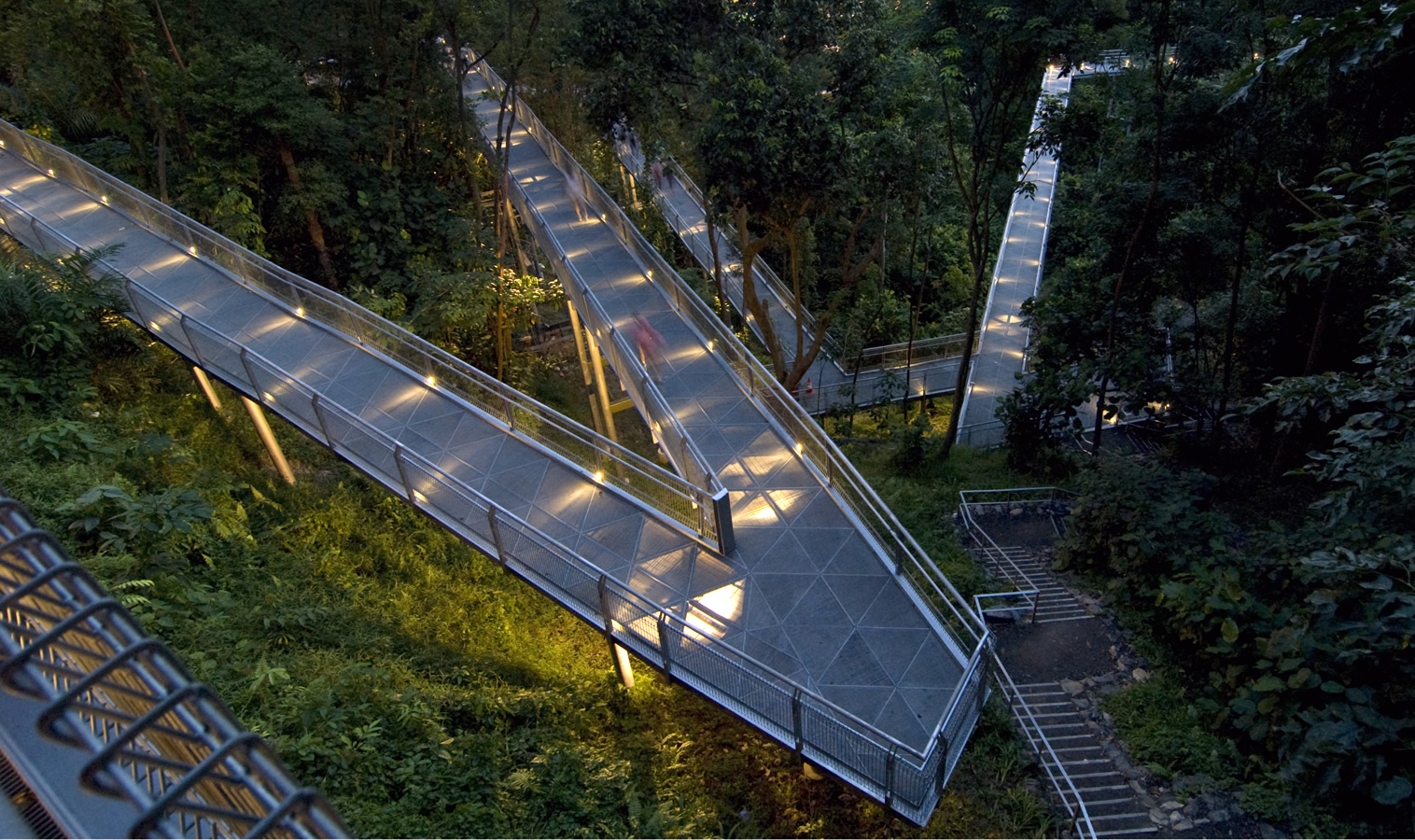
The 1.3 kilometre, step-free Forest Walk is an elevated walkway that offers an unobstructed view of the secondary forest canopy. For those who are afraid of heights, embark on the Earth Trail, a rugged path that runs parallel to the Forest Walk.
You may be interested in: The Ultimate Guide to Singapore’s Offshore Islands
Alexendra Arch
Another key linkage along the Southern Ridges, the 80-metre long Alexandra Arch connects Forest Walk at Telok Blangah Hill Park to the Floral Walk. Completed in 2008, the steel structure of the bridge is designed to resemble an open-fig leaf. The bridge is lit up at night with color-changing LED lights, forming a spectacular sight for pedestrians and road users alike.
HortPark
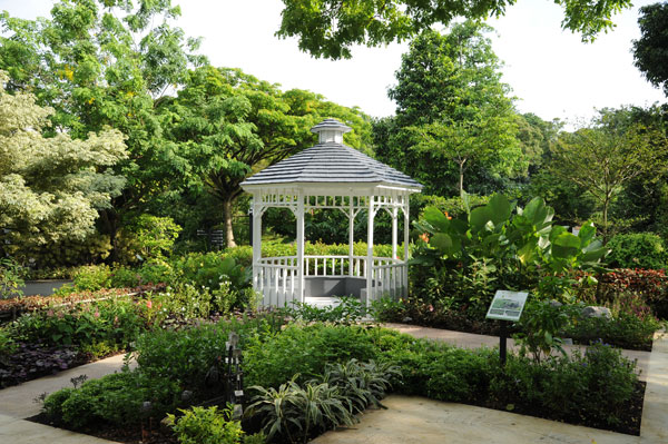
The 23-hectre large Hort Park is designated by NParks as a one-stop resource hub for everything gardening and plant related. This include research, education, recreation and even dining, all under one big canopy.
Themed Gardens
Hort Park is home to 10 themed gardens, each with its curated selection of plant species to reflect its theme. The Edible Garden for instance, features an array of vegetables, herbs and spices used in culinary and medicine.
The Butterfly Garden cultivates suitable nectar and host plants that attracts butterflies, giving visitors a glimpse into the ecosystem that allow the beautiful winged insect to thrive.
The Therapeutic Garden on the other hand, is Singapore’s first therapeutic garden in a public park. The garden features senior-friendly design elements and brightly-colored plants designed to improve mental well-being.
HortCentre
HortCentre is the main building in Hort Park and houses a variety of attractions; The building also serves as a visitor centre and office for NPark staffs and researchers.
HortLawn & Event Lawn
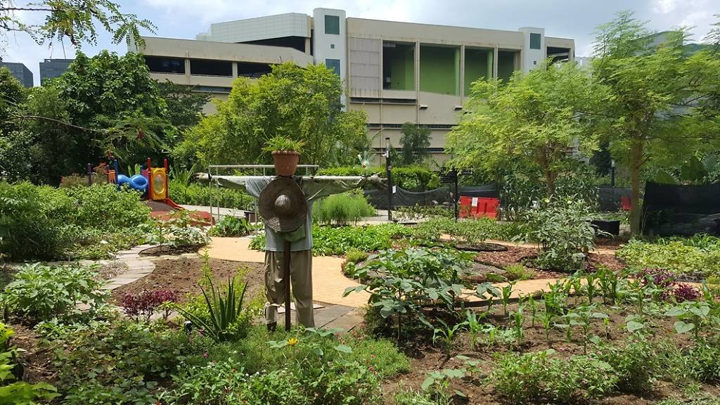
HortLawn and Event Lawn are two large sized field suitable for hosting otudoor activities such as workshops, bazaars and wedding functions.
Guided Tours, Workshops and Events
Tours and workshops are regularly held in HortPark to promote gardening among Singaporeans. The Gardeners’ Day Out is held on every third Saturday of the month where a Garderns’ Market will be opened; free talks and workshops in line with the theme of gardening are also held.
Kent Ridge Park
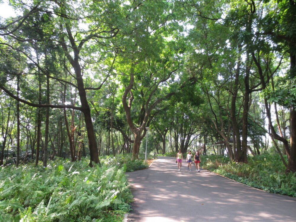
A former plantation for crops such as rubber, pepper and gambier, the 47-hectare large Kent Ridge Park is the site of the historic Battle of Pasir Panjang fought during World War II. Today, it is a popular spot for bird watchers and nature lovers.
Canopy Walk
The 280-metre long canopy walk offers a walk through a secondary forest and links up Kent Ridge Park to the Reflections at Bukit Chandu museum. From there, it is a meandering downslope to HortPark.
Reflections at Bukit Chandu
Housed in a restored black-and-white colonial bungalow, the war museum offers a glimpse of the intense fighting that went on during the Battle of Pasir Panjang on 14 February, 1942. The museum features artefacts and exhibits that invite visitors to relive the battle and discover how Singapore has come so far to become an independent nation.
Labrador Nature Reserve
From WWI forts to rare mangroves trees, the 10-hectare large Labrador Nature Reserve offers a unique blend of nature and history for visitors visiting the nature site.
In 1973, Labrador Nature Reserve was downgraded to a park. The nature site was gazetted as a nature Reserve in 2001, restoring its status to become the smallest of the four nature reserves in Singapore.
Berlayer Creek
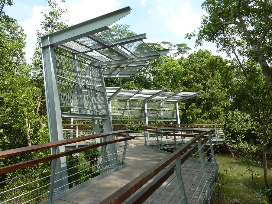
The Berlayer Creek mangrove is one of two remaining mangroves in the south of mainland Singapore. The Berlayer Creek-Bukit Chermin elevated boardwalk takes one along the mangrove and and connects to the promenade at Reflections at Keppel Bay.
WWII Gun Forts
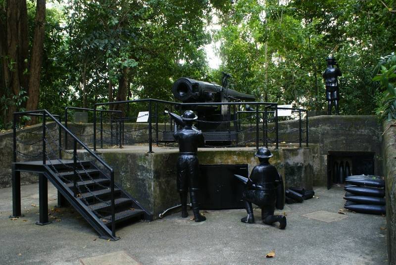
Built in 1878, Labrador Park, then known as Fort Pasir Panjang, was equipped with several guns — two six-inch, 37-ton guns that could fire to a distance of 15 km — to defend the Southern Coast of Singapore.
However, Fort Pasir Panjang did not play the role it had expected as the Japanese Army attacked from the North. Its armour-piercing rounds proved to be ineffective against ground troops.
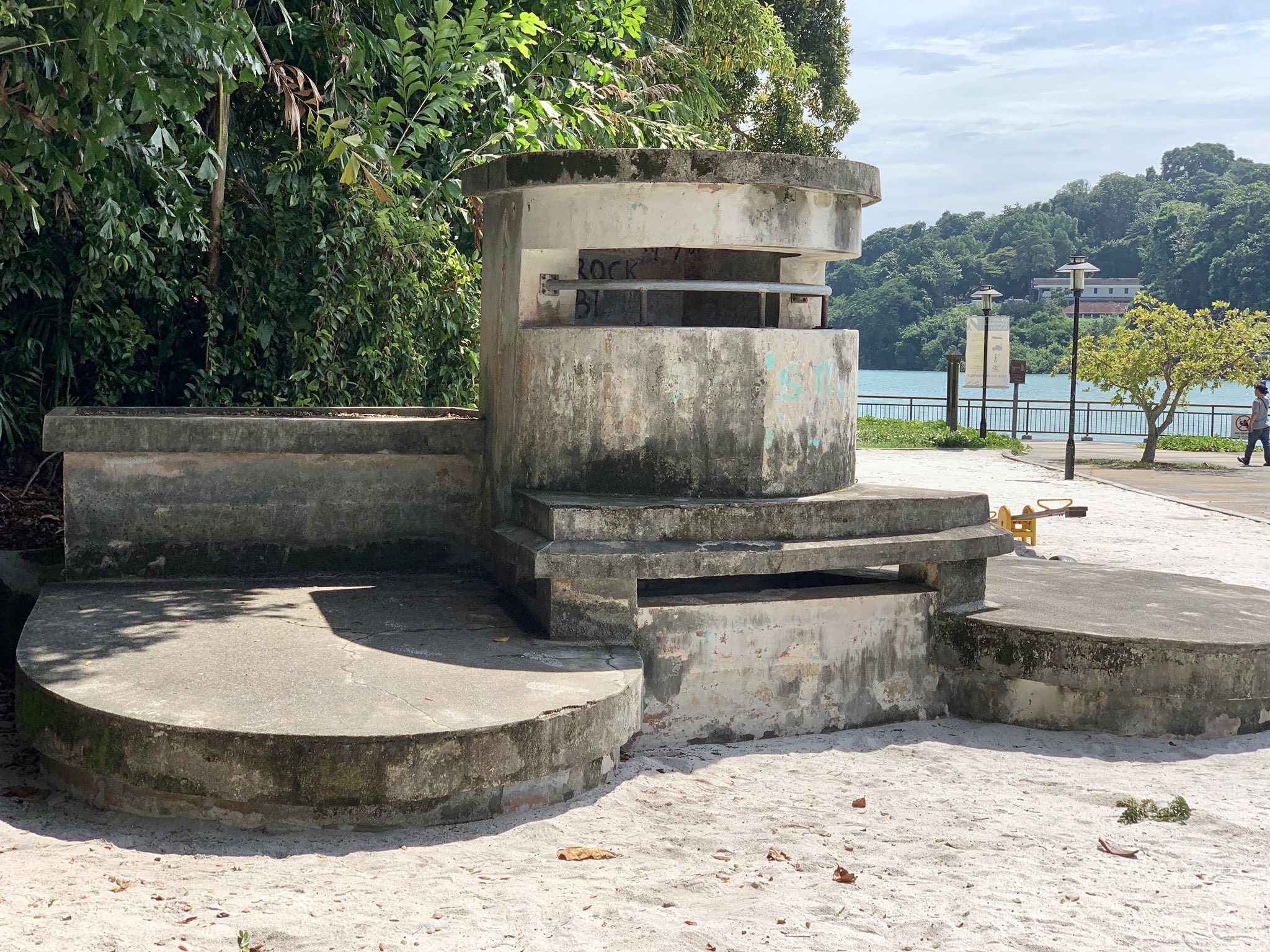
A replica of the gun can be found at the top of the hill. A WWII machine gun post can also be found near the Berlayer Beacon. However, tunnels that once housed the ammunition are now closed to the public.
You may be interested in: The History Behind Marsiling Tunnels
Dragon’s Tooth Gate
Also known as Long Ya Men in Mandarin, the iconic rock structure resembling a tooth was known to be a navigational marker for ships entering the Keppel Harbour, in particular the great Chinese explorer Admiral Zheng He. The original rock however, was blown up in 1848 to expand the Keppel Straits. A replica was erected at the reserve in 2005.
A stone’s throw away from the Dragon’s Tooth Gate is the red-colored Berlayer Beacon, a navigational marker for ships along the southern coast of Singapore.

